
Old Mission Point, Michigan
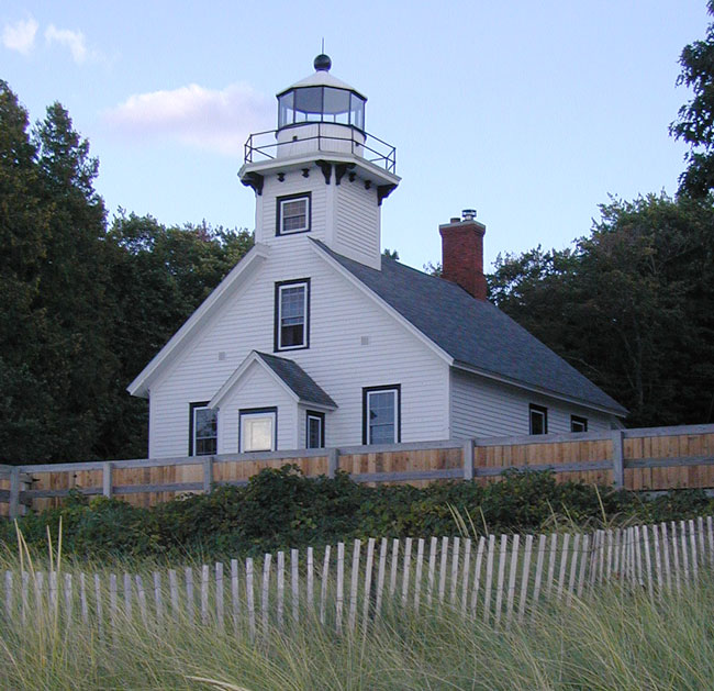
At the end of Old Mission Point north of Traverse City, Michigan is the picturesque Mission Lighthouse which once warned mariners of the sandy shoals off the point. The light was automated in 1933 and an offshore automatic light replacement built in 1938. The land around the lighthouse became a public park in 1931 but the lighthouse suffered vandalism and neglect until a group of local residents raised the funds to purchase and preserve the building in 1948. At the time when I visited in 2002, the lighthouse was still used as a caretakers' residence owned by Old Mission Historical Society, but in 2008 the lighthouse opened to the public as a small museum which is open in the summer months.
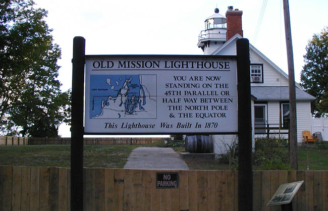
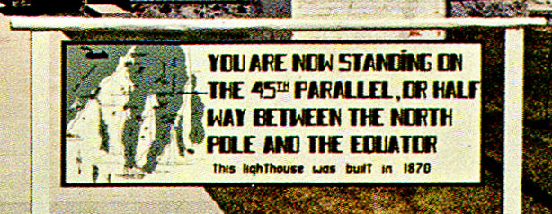
Over the gate facing the parking lot there is a sign declaring that the reader is standing directly on the 45th Parallel, at the magical point half-way between the North Pole and the Equator. The sidewalk beyond the gate makes it easy to imagine the invisible line heading out across Traverse Bay to the west, with the reader's left foot south of the line and right foot north of it. But none of this is actually true.
|
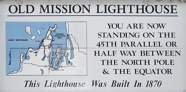
Old Mission Lighthouse You are now standing on the 45th Parallel or half way between the North Pole & the Equator This Lighthouse Was Built in 1870 |
Firstly, the 45th Parallel line does not exactly match the halfway point between the North Pole and Equator, due to the bulge of the spinning earth. Secondly, the 45th Parallel does not pass through this point but lies a few hundred feet north of the tip of the peninsula. The east-west line drawn on the map on the sign does not show the correct position of the 45th Parallel.
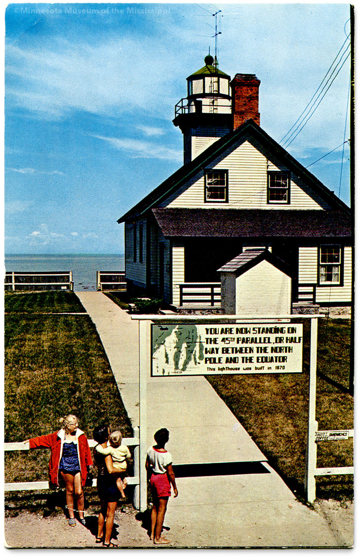
The incorrect sign at the lighthouse has been there for many years. A vintage postcard from the 1960s shows an earlier version of the sign with a very similar map and the same misleading text, though written in an attractive futuristic hand-lettered font.
How long has the Old Mission Lighthouse been boasting these incorrect claims? Has a similar sign been here since the park opened in 1931? An article in the Detroit Free Press from June 1936 describes a summer solstice pageant put on here at precisely 9:22 am by local cherry growers to welcome the summer sun before the upcoming National Cherry Festival:
"Modifying Chippewa Indian tribal customs, a group of dancing girls with flowers in their arms, danced up to the parallel and presented their blooms to Miss Ardis Manney, of Northport, who as queen of the 1936 National Cherry Festival represented the spirit of summer. It was Queen Ardis' first appearance since her selection in a contest Friday."
The pageant's organizers hoped to make the ceremony an annual part of the cherry festival, though its unclear how many other years it was staged. But the idea that the 45th Parallel ran precisely through this spot continued long after such pageants fell out of fashion. To be sure, the real parallel is not far away, and the marker is far closer to the right location than the rock cairn just a few miles across Traverse Bay to the east which was erected two years later in 1938.
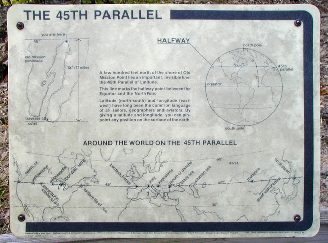
Down a trail closer to the beach from the lighthouse there is a newer sign created by Land Planning & Design Associates of East Lansing in the 1990s. The sign includes a more-precise map of the peninsula and the location of the invisible line running through the bay just north of the shore:
|
The 45th Parallel A few hundred feet north of the shore of Old Mission Point lies an important, invisible line: the 45th Parallel of Latitude. This line marks the halfway point between the Equator and the North Pole. Latitude (north-south) and longitude (east-west) have long been the common language of all sailors, geographers and aviators. By giving a latitude and longitude, you can pin-point any position on the surface of the earth. |
View 45th Parallel Markers in Google Maps