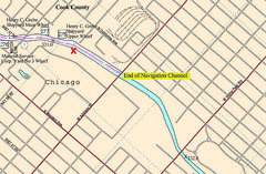
The Army Corps of Engineers has all the navigation charts for the Illinois & Chicago Rivers online in pdf format. I knew I'd seen these a few years ago, but it took a while to re-find them:
« Walk In The Water | Main | Complications »
The Army Corps of Engineers has all the navigation charts for the Illinois & Chicago Rivers online in pdf format. I knew I'd seen these a few years ago, but it took a while to re-find them:
This page contains a single entry from the blog posted on August 8, 2007 7:51 PM.
The previous post in this blog was Walk In The Water.
The next post in this blog is Complications.
Many more can be found on the main index page or by looking through the archives.